


Gorani

Easy, fast 3D terrain and diagram maker

Gorani is a free, open-source plugin for Rhino, SketchUp, and Blender users.

3D model

Site context from open data

No SHP files needed. Click your site on the map and generate, and buildings, roads, terrain and water go into the open document on separate layers.

  • Buildings
  • Roads
  • Terrain
  • Water
  • Green space
  • Rail
  • Parcels
2D set

Don't pull all‑nighters on site analysis

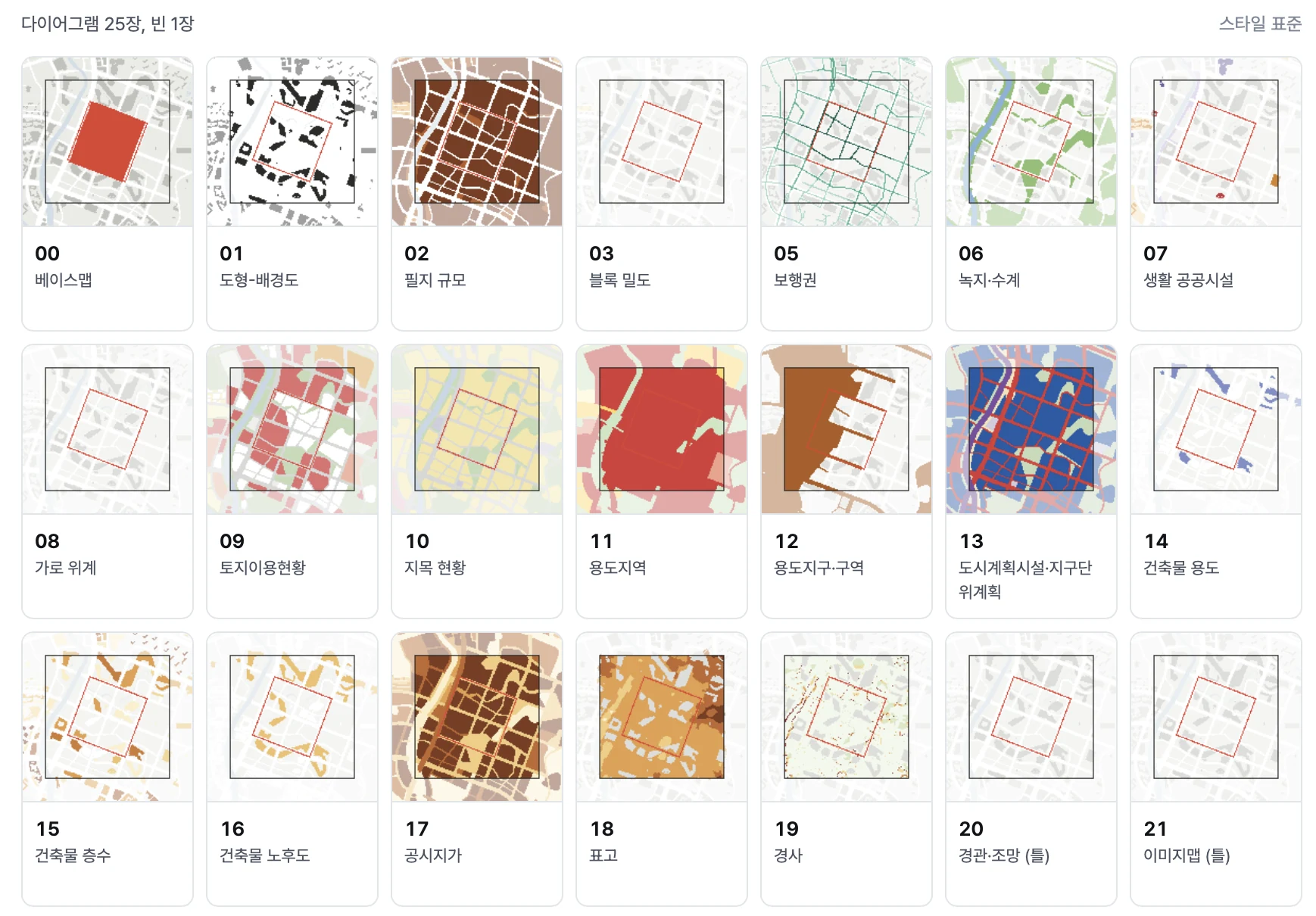
22 diagrams, from figure-ground and zoning to land use, come as editable SVG files. You can change their colors and style, too.

  • Basemapbasemap_scale.ai
  • Analysis mapssheets/*.svg, .ai
  • Parcel and building tablestables/*.csv

Supported tools

Gorani is a free, open-source plugin for Rhino, SketchUp, and Blender users.

Install

Quick install

Rhino’s Package Manager opens with Gorani already searched.

  1. Open Package Manager

    Type in the Rhino command line

    PackageManager
  2. Install Gorani

    Search for Gorani and press Install

  3. Restart Rhino

  4. Open the panel

    Type in the command line

    Gorani

How to use

The first run in a new area takes a little longer while it downloads data. If something breaks, check log.txt in the result folder.

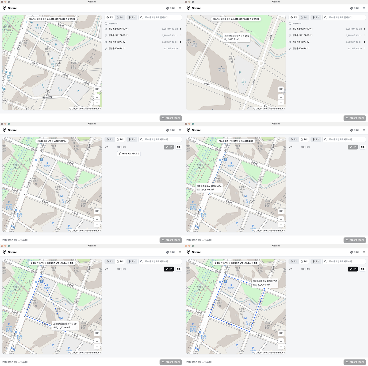
  1. Animation of Gorani selecting parcels and drawing an area, with selection points and site information changing on the map.

    1Pick a site

    Find the site on the map, or search by address or parcel number. Click parcels or draw an area to set the site.

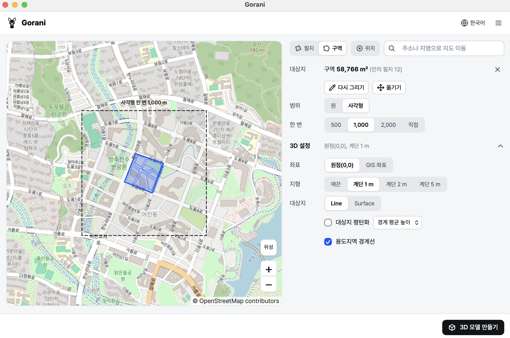
  2. Gorani 3D settings over Rhino, showing the origin, terrain contour interval, site flattening and zoning boundary options.

    2Make the 3D model

    Set the range and 3D options and press build. Buildings, roads, terrain and water go into your open Rhino file, layer by layer.

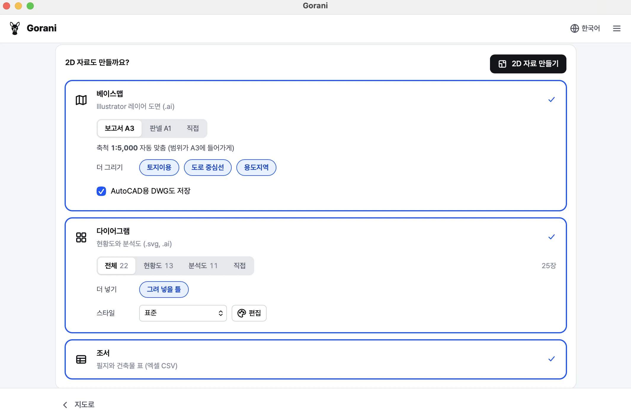
  3. After the 3D model is complete, Gorani shows the 2D set selection screen with basemap, diagrams, tables and the Make 2D set button.

    3Make the 2D set

    The basemap (.ai), analysis maps and tables (CSV) are saved to the result folder. Other basemap scales are one click away.

  4. Grid of 25 Gorani diagram previews, including basemap, figure-ground, parcel size, zoning and building analysis maps.

    4Check the drawings

    Open any drawing large right in the panel. Change diagram colors and styles and make them again.

Coverage and data sources

Gorani works worldwide on top of OpenStreetMap. Click a card to see each country’s data sources.

FAQ

Is it really free?

Yes, and no account is needed. It runs on sponsorships.

Do I need Grasshopper or other software?

No. You only need Rhino 7+, SketchUp 2022+ or Blender 4.2+, on Windows or macOS.

Does it work in Rhino 7?

Yes. The installation is the same, and PackageManager picks the Rhino 7 build. On Windows the panel opens in an Edge window, and DWG export is not available.

Where are the results saved?

The 3D model goes into the open document. Files are saved to ~/Gorani/result/site_date/: the model file, log.txt and the 2D/ folder.

Something went wrong. What should I do?

First check log.txt in the result folder. If that doesn't solve it, please open an issue on GitHub Issues and attach log.txt. No GitHub account? Use the contact form below.

Release notes

Updates and release notes across supported 3D applications.

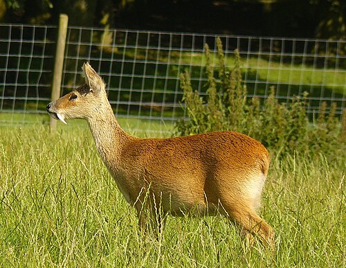
[고라니] [Water deer]

The water deer (Hydropotes inermis) is a small deer native to Korea and China. Males have long tusks instead of antlers, and usually live near rivers, reed beds and wetlands.

Taxonomy 분류

The water deer belongs to the deer family and is the only living species in the genus Hydropotes. Its lack of antlers and prominent tusks distinguish it from most other deer and give it a separate genus.

Etymology 어원

The genus name Hydropotes refers to water, reflecting the animal's association with rivers and wetlands. The species name inermis means unarmed, referring to the absence of antlers.

A male water deer standing in grass Male water deer From Wikipedia, the free encyclopedia